Learn to read the hidden language of utility marks, hobo codes, and survey symbols etched into city sidewalks and alleyways.
Cities write on themselves constantly. Utility crews spray-paint cryptic codes before digging. Surveyors chisel coordinates into concrete. Contractors stamp dates into wet sidewalks. Even hobos from the 1930s left symbols warning or welcoming those who came after. Most people step over these marks daily without seeing them. This quest teaches you to spot, photograph, and decode the infrastructure language hiding in plain sight.
The best hunting grounds are older neighborhoods where layers of time stack up—look for faded paint over older paint, metal survey disks embedded in corners, and those mysterious colored markings that appear days before construction crews arrive. Early morning or late afternoon light reveals shallow engravings that disappear in harsh noon sun. You're not vandalizing or trespassing; you're reading public infrastructure like an archaeologist reads pottery shards.
This isn't about finding Instagram-perfect street art. It's about training your eye to see systems—how a city coordinates its underground maze of pipes, wires, and tunnels through a visual shorthand that's been evolving for over a century. Once you learn the codes, every walk becomes a treasure hunt through municipal archaeology.
Why This Quest Matters
You'll stop being a tourist on your own sidewalks. Every block becomes a puzzle where spray-painted hieroglyphics reveal what's buried below and what's about to be dug up. Once you crack the code, you see the city as crews see it—a grid of layered systems all talking to each other in fluorescent shorthand.
What You'll Experience
How to decode the APWA utility color system and local variations
Where to find and interpret brass survey markers and their coordinate systems
The visual grammar cities use to coordinate underground infrastructure
How to read construction timelines from temporary marks before crews arrive
Techniques for photographing ephemeral markings that fade within weeks
What You'll Need
Top gear to make this quest great.
Pull it off
Macro Lens Clip Attachment for Phone
Captures fine detail in faded paint, stamped numbers, and shallow engravings that standard phone cameras miss. Essential for reading dates on old survey markers and documenting layered markings.
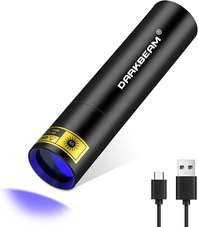
Reveals hidden or faded markings on concrete and asphalt that are invisible in normal light. Older surveyor paints and some utility codes fluoresce under UV, adding a hidden layer to your archaeological hunt.
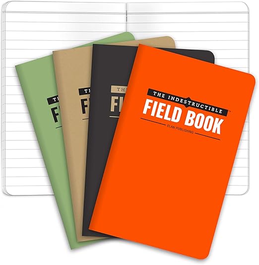
Documents marking locations and sketches symbol variations when photographing isn't practical. Grid paper helps you map spatial relationships between marks. Survives unexpected rain that would destroy regular paper.
As an Amazon Associate I earn from qualifying purchases. Prices may change.
Step-by-Step Guide
1
Scout your six-block archaeology zone
Choose a pre-1980s neighborhood where construction layers have stacked up over decades. Start at intersections and alleyways where utility lines cross—this is where markings cluster. Keep your eyes on the pavement, not the storefronts.
💡 Pro Tips:
• Avoid newly developed areas where fresh pavement has erased the palimpsest
• Early morning or late afternoon light reveals shallow engravings that vanish at noon
2
Photograph every marking without glare
Document spray-paint codes, stamped contractor marks, and embedded metal disks. Use a macro lens attachment positioned to eliminate reflections. These marks are temporary communication between crews—some will fade within weeks.
💡 Pro Tips:
• Bring a UV flashlight for dusk walks; older surveyor paints and railroad chalk sometimes fluoresce
3
Decode utility paint using color codes
Learn the APWA standard: White (proposed dig), Red (electric), Yellow (gas/oil), Orange (telecom), Blue (water), Green (sewer), Purple (reclaimed water). Note when your city uses local variations. Watch for overlapping marks where infrastructure gets dense.
💡 Pro Tips:
• Photograph color combinations as they appear—utilities often layer codes to show complexity
4
Hunt for brass survey markers
Search concrete at property corners and high points for stamped disks showing dates and coordinates. These permanent marks anchor the entire municipal measurement system. USGS and local surveying offices maintain databases you can cross-reference at home.
5
Map and document three marking types
Record fresh utility paint, dated contractor stamps, and any historical symbols like depression-era hobo codes near rail yards. Plot findings on grid paper or GPS. Intersection points where marks overlap reveal how many systems share that underground real estate.
6
Research one type, then revisit in three months
Dig deeper into utility company codes, historical society records on hobo symbols, or surveying forums. Return to your route after a season—watch marks fade, get buried under new paint, or accurately predict where construction crews tore up the street.
Captures fine detail in faded paint, stamped numbers, and shallow engravings that standard phone cameras miss. Essential for reading dates on old survey markers and documenting layered markings.
Reveals hidden or faded markings on concrete and asphalt that are invisible in normal light. Older surveyor paints and some utility codes fluoresce under UV, adding a hidden layer to your archaeological hunt.
Documents marking locations and sketches symbol variations when photographing isn't practical. Grid paper helps you map spatial relationships between marks. Survives unexpected rain that would destroy regular paper.
Compact all-weather notebook with grid or dot pages
Gets you comfortably close to pavement level for extended photography sessions without destroying your knees. Most marks require low-angle shots, and concrete is unforgiving after 20 minutes of crouching.
Portable foam or gel knee cushion used by gardeners
Architecture Scavenger Hunt: Decode Your City's Hidden Design Language
That building you pass every day? It's been screaming details at you that you've never noticed.
Hunt for architectural details hiding in plain sight—corbels, keystones, terra cotta faces, and century-old brickwork patterns that tell your city's real story.
Your city is a transportation laboratory—time to run experiments on every option available.
Map and test every alternative transportation option in your city—e-scooters, bike shares, electric mopeds, and micro-transit networks. Build your personal mobility intelligence.
4-6 hours (spread over multiple days)Gear from $15
The best food in your city isn't on Yelp's front page—it's where rent is cheap and menus aren't in English.
Navigate your city's authentic food scene through ethnic markets, street vendors, craft breweries, and neighborhood joints that locals actually frequent.